PHOTOS: Downtown Pittsburgh Before Point State Park
Image 0 of 16
Downtown Pittsburgh before Point State Park Pittsburgh, Pennsylvania. , . [No Date Recorded on Shelflist Card] [Photograph] Retrieved from the Library of Congress, https://www.loc.gov/item/2003681825/. (Library of Congress)
Downtown Pittsburgh before Point State Park Detroit Publishing Co, C. C. & Detroit Publishing Co, P. The Point, Pittsburgh, Pa. Monongahela River Monongahela River. Pennsylvania Pittsburgh Pittsburgh. United States, None. [Between 1900 and 1915] [Photograph] Retrieved from the Library of Congress, https://www.loc.gov/item/2016802438/. (Library of Congress)
Downtown Pittsburgh before Point State Park Detroit Publishing Co, C. C. & Detroit Publishing Co, P. The Point, Pittsburgh, Pa. Pennsylvania Pittsburgh Pittsburgh. United States, None. [Cbetween 1900 and 1910] [Photograph] Retrieved from the Library of Congress, https://www.loc.gov/item/2016815077/. (Library of Congress)
Pittburgh's Point A general view of the North Side Point Bridge from Mount Washington. The image shows the Manchester Bridge, Point Bridge, the Pittsburgh Exposition (Including Roller Coaster), the North Shore, Monument Hill and Exposition Field, June 8, 1916. (Archives & Special Collections, University of Pittsburgh Library System)
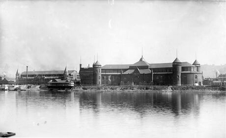
Exposition Buildings Exposition Building in Pittsburgh's Point Park. The last exhibition was held at the Exposition Building in 1916. In the years following, the buildings were used for various purposes, with the last remains being torn down in 1950 to accommodate the new Duquesne Way artery. (Archives & Special Collections, University of Pittsburgh Library System)
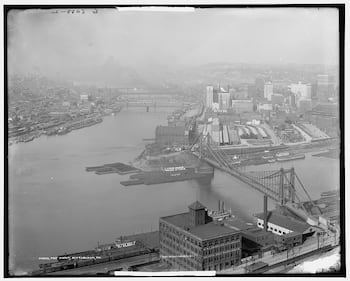
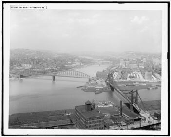
Downtown Pittsburgh before Point State Park Detroit Publishing Co, P. Confluence of Allegheny and Monongahela rivers, Pittsburgh, Pa. Allegheny River Allegheny River. Monongahela River Monongahela River. Pennsylvania Pittsburgh Pittsburgh. United States, None. [Between 1910 and 1920] [Photograph] Retrieved from the Library of Congress, https://www.loc.gov/item/2016814067/. (Library of Congress)
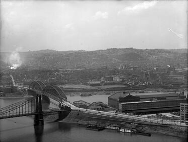
Downtown Pittsburgh before Point State Park Detroit Publishing Co, C. C. & Detroit Publishing Co, P. The Point, Pittsburgh, Pa. Allegheny River Allegheny River. Monongahela River Monongahela River. Pennsylvania Pittsburgh Pittsburgh. United States, None. [Cbetween 1910 and 1920] [Photograph] Retrieved from the Library of Congress, https://www.loc.gov/item/2016814086/. (Library of Congress)
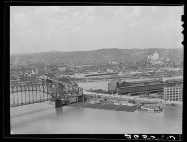
Downtown Pittsburgh before Point State Park Rothstein, A., photographer. (1938) Junction of the Allegheny and Monongahela Rivers to form the Ohio. Pittsburgh, Pennsylvania. Allegheny County Pennsylvania Pittsburgh Pittsburgh. United States, 1938. July. [Photograph] Retrieved from the Library of Congress, https://www.loc.gov/item/2017776822/. (Library of Congress)
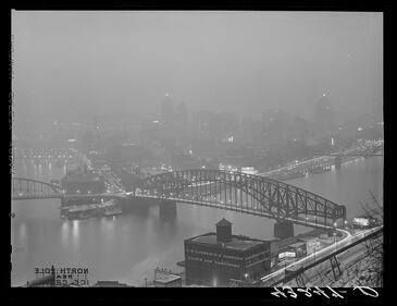
Downtown Pittsburgh before Point State Park Delano, J., photographer. (1941) Pittsburgh, Pennsylvania in the evening. Allegheny County Pennsylvania Pittsburgh Pittsburgh. United States, 1941. Feb. [Photograph] Retrieved from the Library of Congress, https://www.loc.gov/item/2017793614/. (Library of Congress)
View of the Point General view of the Fort Pitt exploration area from Duquesne Heights, January 14, 1942. (Archives & Special Collections, University of Pittsburgh Library System)
Downtown Pittsburgh 1943 A view of the Golden Triangle, the North Side, and the Hill District, with the Cathedral of Learning in the background, 1943. (Archives & Special Collections, University of Pittsburgh Library System)
Golden Triangle, 1951. View from the top of 525 William Penn Place building, looking west to the Point and the Farmers Bank Building, January 23, 1951. (Archives & Special Collections, University of Pittsburgh Library System)
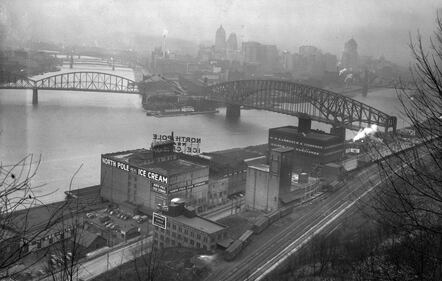
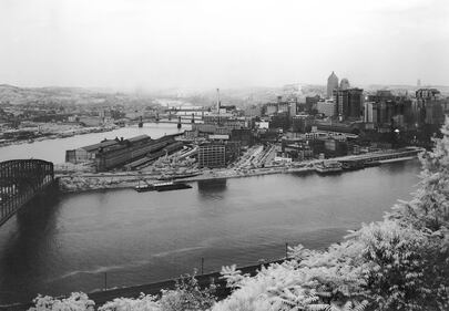
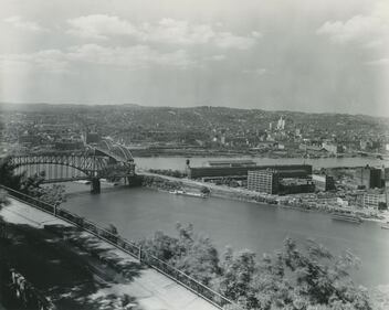
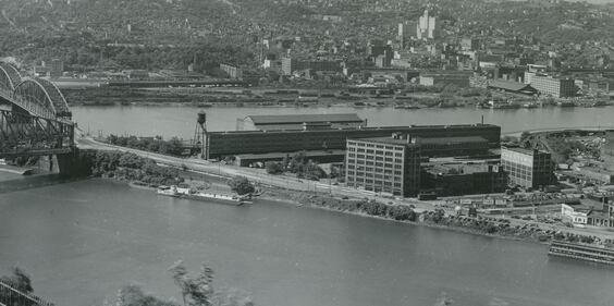
Pittsburgh's Point By 1954 a few of the old industrial buildings remained at the Point before demolition to make way for Point State Park began. To the left are the Point Bridge (background) spanning the Monongahela River from the South Side neighborhood of Pittsburgh to the Point, and the Manchester Bridge (behind the Point Bridge) spanning the Allegheny River from the Point to the North Side section of Pittsburgh. The tall white building on the opposite side of the Allegheny River (center right) is Allegheny General Hospital. (Allegheny Conference on Community Development Photographs, Detre Library & Archives, Heinz History Center)
Pittsburgh's Point By 1954 a few of the old industrial buildings remained at the Point before demolition to make way for Point State Park began. To the left are the Point Bridge (background) spanning the Monongahela River from the South Side neighborhood of Pittsburgh to the Point, and the Manchester Bridge (behind the Point Bridge) spanning the Allegheny River from the Point to the North Side section of Pittsburgh. The tall white building on the opposite side of the Allegheny River (center right) is Allegheny General Hospital. (Allegheny Conference on Community Development Photographs, Detre Library & Archives, Heinz History Center)


/cloudfront-us-east-1.images.arcpublishing.com/cmg/XCUXZC2XYZHCRGNNGKFEX6U3LQ.png)


