PITTSBURGH — UPDATE 11 p.m.: Make sure you check the driveway, sidewalks and front steps before you head out because refreeze will be an issue in the morning.
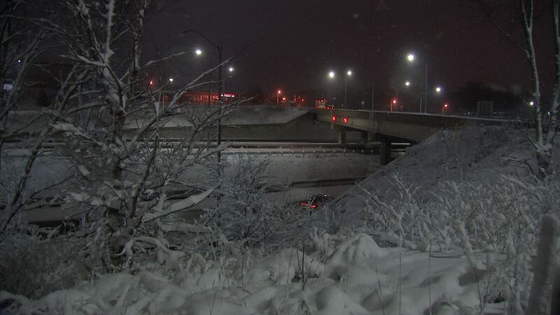
And you’ll have to slow down when it comes to bridges and on-ramps as well.
The reason is that cold air is moving above and below those elevated surfaces, so it’s going to cool off faster or keep it cold.
Experts said even treated surfaces could be a problem if you don’t have the right product or get more snow.
Also, the thermometer in your car doesn’t give you the road temperature, and that’s what determines if the road freezes or if the snow will stick.
If the road looks wet, slow down because it could be black ice.
One more thing -- make sure you pay attention to those yellow signs that read “bridge may ice in cold weather.”
Give yourself a little extra time in the morning for the roads and other drivers on the road.
UPDATE 7 p.m.: The City of Greensburg saw about 2-3 inches overnight into Tuesday, but luckily the roads didn’t get very covered.
Conditions were slick, but not much snow stuck to the streets themselves.
UPDATE 6:10 p.m.: A portion of a busy road was shut down following a 10- vehicle crash, according to Allegheny County.
The crash happened on Bigelow Boulevard in front of Frank Curto Park in Pittsburgh’s Crawford-Roberts neighborhood.
UPDATE 6:15 p.m.: PennDOT officials said with the higher road temperatures this morning, there were no incidents Tuesday on the turnpike.
While they were prepared for the worst-case scenario, it turned out much better than expected for the season’s first snow.
Crews will continue to plow the turnpike overnight, monitoring conditions as they come. They will be on 24-hour schedules until the snow stops.
UPDATE 5 p.m.: Periods of snow will continue through early Wednesday before gradually ending as a few snow flurries.
Moderate to heavy bands of snow will be possible, especially north of Pittsburgh, bringing additional accumulations of 3-5 inches. The Pittsburgh area should see another inch to as much as two inches in spots through Wednesday morning.
LIVE Interactive Radar
Temperatures will stay below freezing through the night, so watch for icy spots. Bursts of steady snow could quickly coat roads, especially bridges or overpasses.
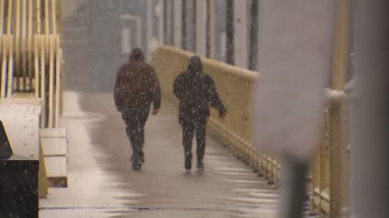
Allow some extra time and layer up as you head out to clear your windshield and the sidewalk again Wednesday, with wind chills forecast to drop into the teens.
UPDATE 4:15 p.m.: The winter storm warning now includes Armstrong, Butler and Lawrence counties through Wednesday.
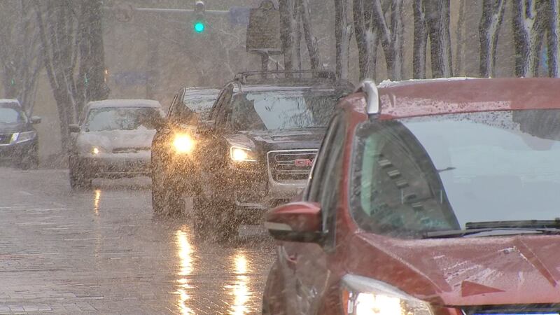
Snow could be moderate-to-heavy at times across our area, creating slick conditions on roads.
NEW Winter Storm Warning update adding Butler, Lawrence, Armstrong. Snow could be moderate to heavy at times. LIVE Storm Tracker Doppler 11 Radar tracking this system next-Channel 11 News 5pm. pic.twitter.com/Hc82Sc9ANZ
— Stephen Cropper (@WPXICropper) December 1, 2020
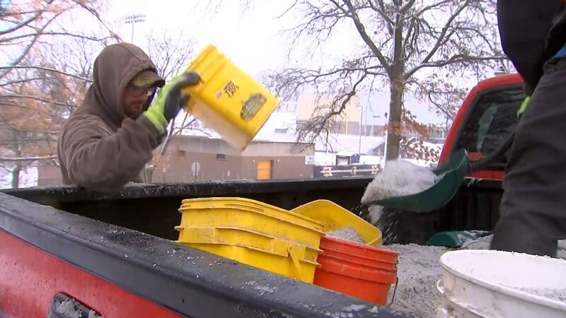
UPDATE 3:50 p.m.: The Pittsburgh Department of Public Works said it will continue to work through Tuesday evening and overnight to treat city roads during the ongoing snowfall.
DPW originally boosted its Monday overnight shift to begin treating streets with blue-tinted magnesium chloride salt in advance of this morning’s rush hour. Now it is extending its daylight shift by four hours to work until 6 p.m. and bringing in overnight workers early for a 12-hour shift that also begins at 6 p.m.
Temperatures are expected to begin rising late Wednesday morning, which should help road conditions improve further.
UPDATE 2:45 p.m.: Snow showers will continue through the evening, ending as a few snow showers or flurries Wednesday.
Our region has seen upwards of five inches of snow so far through Tuesday afternoon. Ohiopyle even reached 8.5 inches already, while social media posts claim Plum and Butler have surpassed five inches.
First day of "meteorological" Winter and some healthy snow totals. Heavy wet snow, so a broom might not do the trick. pic.twitter.com/M7Wl5icDVO
— Stephen Cropper (@WPXICropper) December 1, 2020
A band of moderate snow might develop near Cleveland and drift south through the evening. Right now, primary impacts look to be north of Pittsburgh (possibly as far south as Butler) near I-80.
WINTER WONDERLAND: This is how it looks outside the station. Just visually mesmerizing. #PAwx #Pittsburgh @WPXI pic.twitter.com/CIcEEjjoUK
— Jessica Faith (@JessicaWPXI) December 1, 2020

UPDATE 1:05 p.m.: Channel 11 crews have been around the Pittsburgh area getting a feel for how driving conditions are during the season’s first snow.
So far, the snow has just accumulated in yards and sidewalks, while the roads look fairly clear. However, it is very cold outside.
The good thing about this mask - it’s keeping my face warm! 😷 @WPXI pic.twitter.com/cA2kHwpByv
— Gabriella DeLuca (@GabriellaDeLuca) December 1, 2020
It’s a winter wonderland in the South Hills! I’m live as kids are out sledding..in minutes on @wpxi! 🛷 pic.twitter.com/Z0fALO5tcI
— Liz Kilmer (@LizKilmerWPXI) December 1, 2020
Snow everywhere we go today ❄️❄️❄️ @WPXI pic.twitter.com/Dj59TW1ebC
— Gabriella DeLuca (@GabriellaDeLuca) December 1, 2020
The winter wonderland that is Riverview Park and Allegheny Observatory. #WPXI #PGH #Pittsburgh @WPXIWeather #snow pic.twitter.com/SWSPCF97Wz
— Tony Ruffolo (@WPXITonyRuffolo) December 1, 2020
UPDATE 11:55 a.m.: Several inches of snow have accumulated on grassy areas on Pittsburgh’s North Shore, but roads are primarily only wet.
LIVE Interactive Radar
The Allegheny County Department of Public Works sent out 26 trucks at 4 a.m. to treat roads and bridges. They will work until the snow stops.
In the city, 55 crews are treating and plowing for as long as needed.
Up in Butler County, crews are also out treating the roads and monitoring conditions.
Several inches of snow have fallen in Cranberry Township, where some streets were mainly wet and others were slushy.
>>RELATED STORY: Here’s how road crews across the area are tackling Tuesday’s snow
Plows, salt trucks out and about in Butler County. Rt 68 looking slushy at 9 a.m. @WPXI #pawx pic.twitter.com/MoJ9Q541rq
— Alyssa Raymond (@AlyssaRaymond) December 1, 2020
One family said the first snow of the year is always beautiful.
“They wanted to go out early at 7 a.m. this morning, so they got the snow in the bucket and put it in the freezer for Italian ice,” Andy Brown, of Cranberry, said.
Brown’s children had no problem enjoying the winter weather.
“They will stay out here as long as we let them. I don’t know if nana and papa will make it out that much. They love it and we haven’t had snow for so long, so we’re going to enjoy it,” Debi Brown said.
ORIGINAL STORY: Snow is falling Tuesday morning, and with air temperatures and road temperatures near or below freezing, your morning commute may be impacted by icy roadways.
Drive with extra caution Tuesday, leaving efficient space between you and other vehicles, while driving at a safe speed.
Tuesday will include several hours of decent snowfall. Steady and moderate snowfall is expected at times.
LIVE Interactive Radar
A winter weather advisory is in effect through Wednesday morning for all counties. Impactful snow is expected through the area.
A winter storm warning is in effect through Wednesday morning as well for the mountain ridges of Westmoreland and Fayette counties, and Venango and Mercer counties. Those in the warning will have the highest amounts of accumulation.
If you want to receive alerts about weather, download our Severe Weather Team 11 app.
It will be a blustery day Tuesday. The wind will gust near 30 mph, and wind chill values will be in the teens and 20s.
Flurries will linger into the overnight hours and Wednesday morning, decreasing in coverage. Conditions will clear through the day Wednesday.
Winter Weather Advisories and Winter Storm Warnings posted. I've got updates starting at Noon on @wpxi. #PAwx #Pittsburgh pic.twitter.com/mkNFtUw9Fa
— Danielle Dozier WPXI (@DanielleDozier) November 30, 2020
TRENDING NOW:

Cox Media Group
/cloudfront-us-east-1.images.arcpublishing.com/cmg/XCUXZC2XYZHCRGNNGKFEX6U3LQ.png)


