Pennsylvania — Temperatures in the month of December in Pittsburgh finished above average and they’ve been running much above average so far this January.
The average monthly temperature as of Jan. 10, is 33.4 degrees, which is five degrees above average. Above-average temperatures were forecast for the first part of the month and now, it’s time to evaluate how the rest of the month may finish.
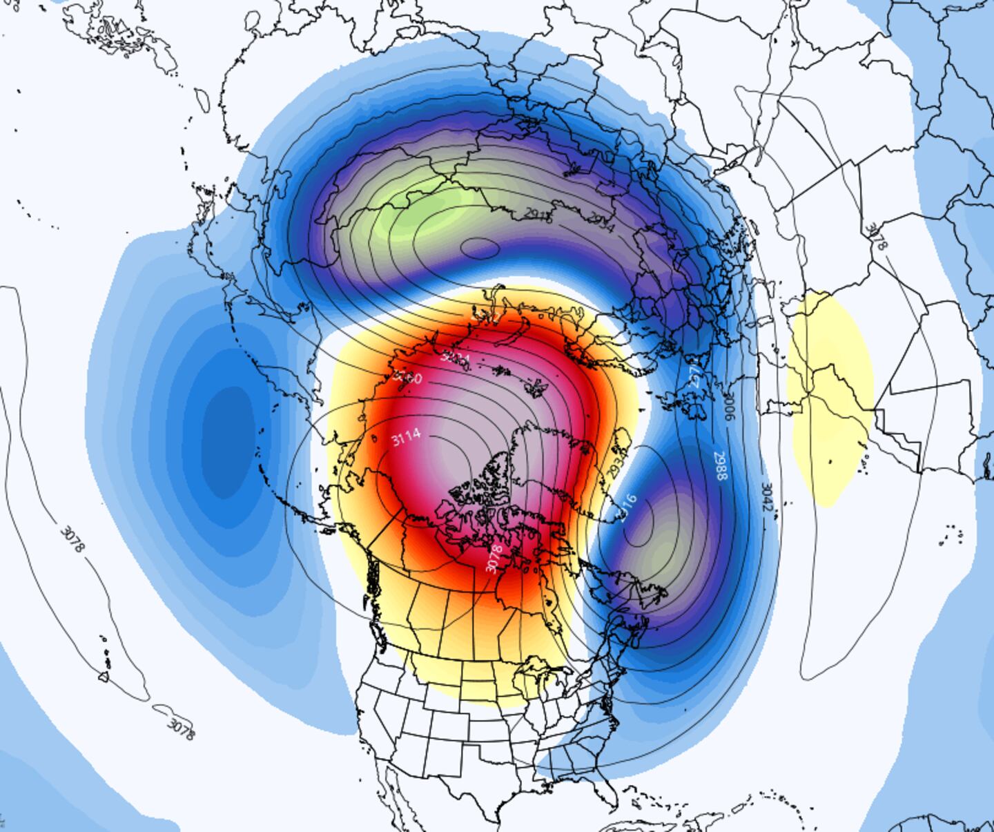
As of mid-January, the polar vortex is weakening and there’s a stratospheric warming event taking place. Remember, the polar vortex is a region of low pressure and very cold air that’s swirling in the polar regions and it’s always there. Sometimes the polar vortex can weaken, or be disrupted, which can lead to very cold air spilling into the eastern U.S.
The polar vortex has shifted from the North Pole over to Europe and the North Atlantic, a sign that stratospheric warming is happening. Sudden stratospheric warming, (or SSW), is when atmospheric waves that are associated with weather systems are able to reach into the stratosphere. This can disrupt the polar vortex.
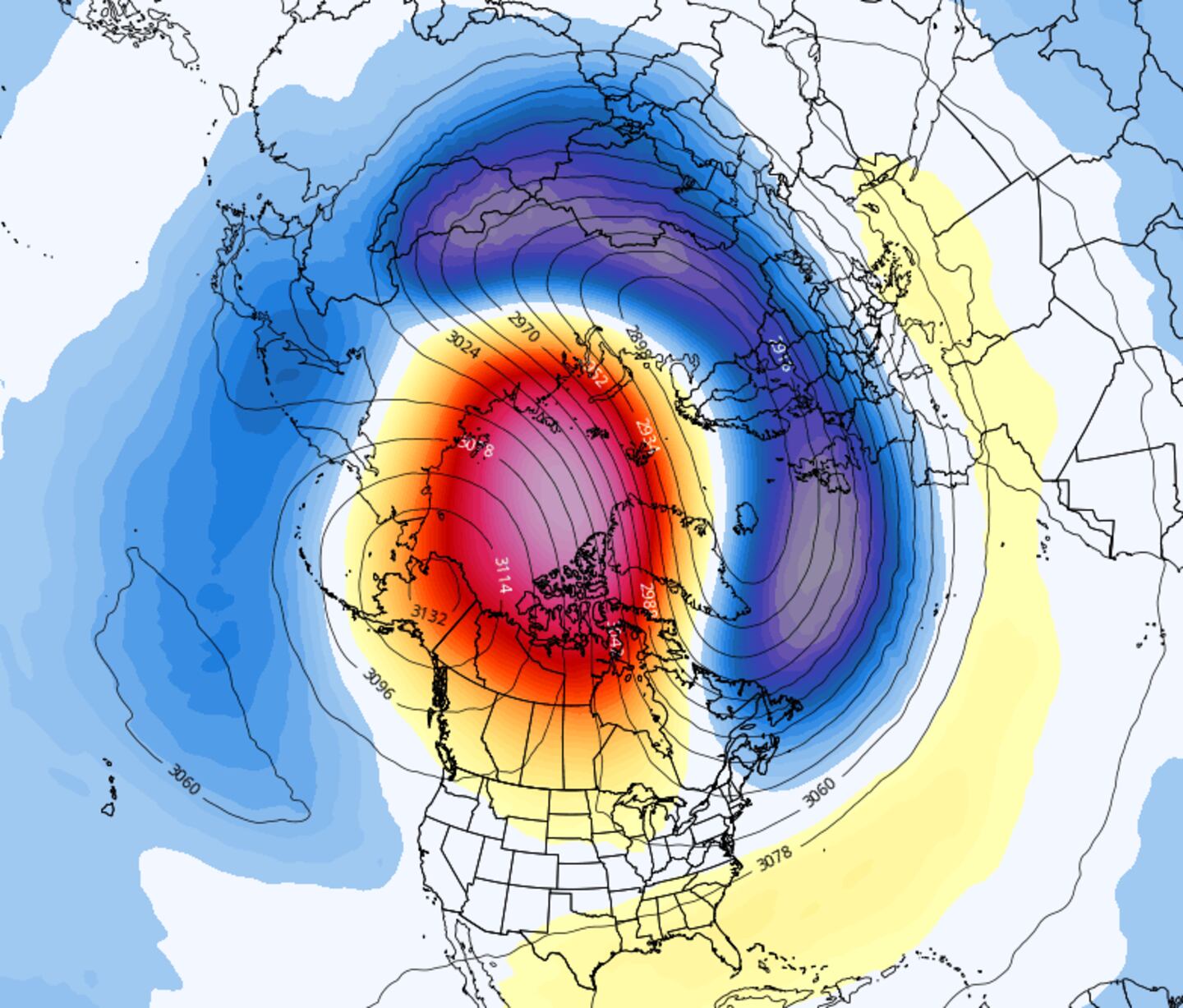
We’re able to see the shift in the polar vortex by looking at what the west-to-east wind is doing way up high in the atmosphere around 10 millibars. Looking at the data, it appears that the polar vortex may split briefly later in the week, with one lobe south of Greenland and another over northern Russia. Shortly after this, it reforms again over northern Russia.
Looking at the high pressure and low-pressure anomalies at 500 millibars in the atmosphere, which is roughly 18,000 feet, we can see there’s a high pressure over the North Atlantic and Greenland. This blocking can lead to more disruptions in the polar vortex and more periods of cold for our part of the country.
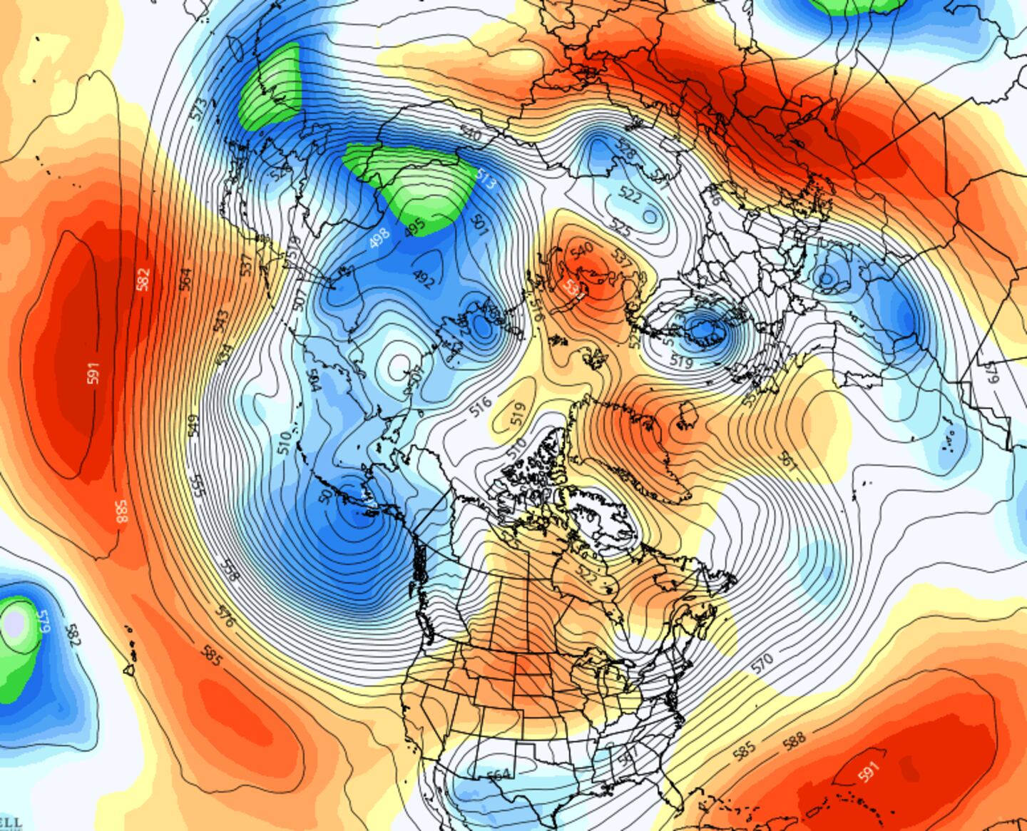

Disruptions in the polar vortex and sudden stratospheric warming can impact our jet stream patterns. In the coming days, a ridge of high pressure is forecast over the west coast, keeping the coldest of air that’s south of the Aleutian Islands from reaching our area. However, a chunk of cold air should be able to “break off” and invade our area from Canada by the weekend of Jan. 16.
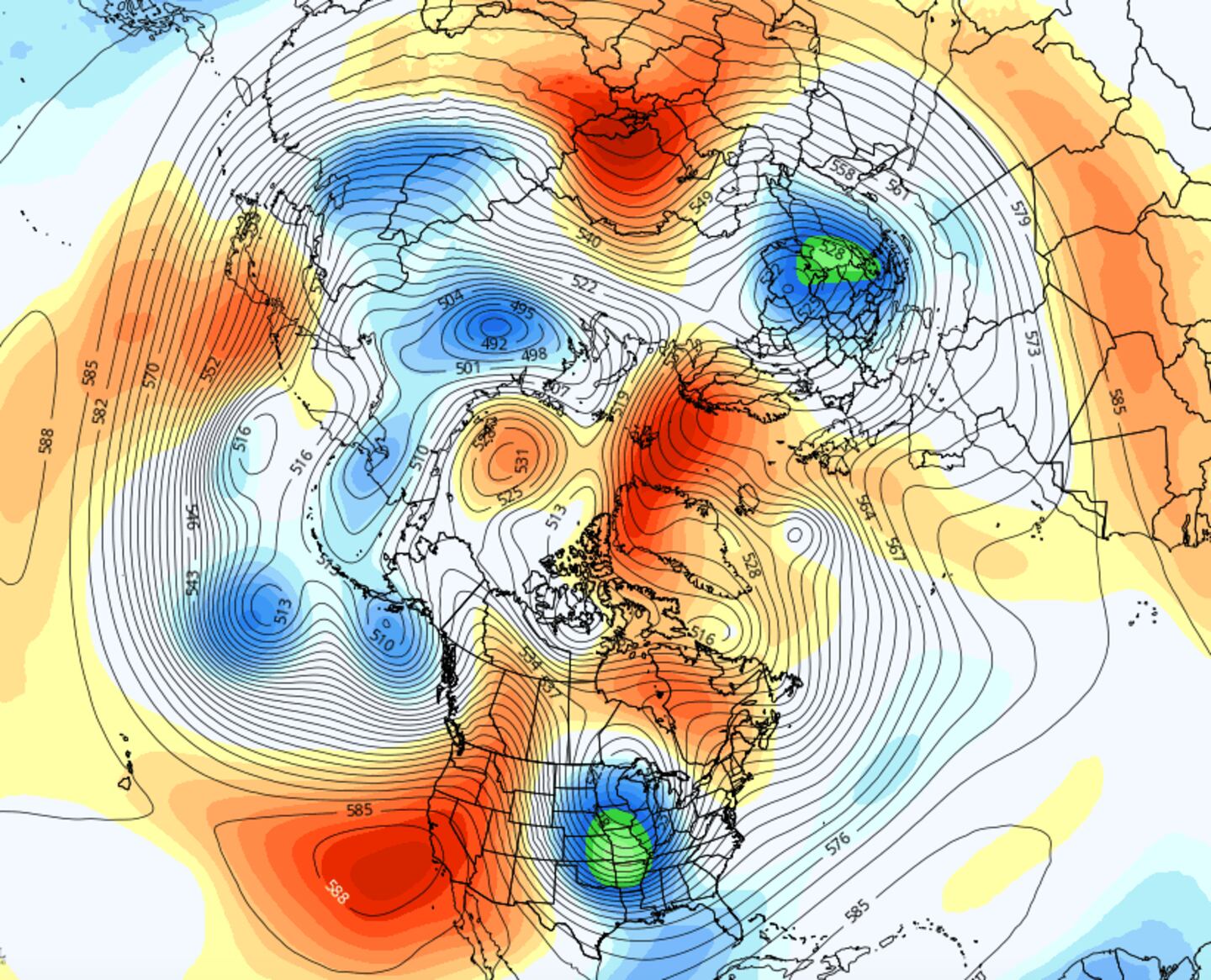
From the middle of the month to the end of the month, the data suggests high pressure over Greenland and high pressure off the west coast, which would allow colder air to move into the eastern U.S., including western Pennsylvania. As this pattern continues, this should lead to some colder-than-average temperatures for the end of the month, if it pans out.
Lake Erie’s water temperatures are still warm and in the upper 30s to low and mid-40s which means that cold air that works its way across the warmer lake could lead to some more lake-effect snow events for our area.
Cox Media Group
/cloudfront-us-east-1.images.arcpublishing.com/cmg/XCUXZC2XYZHCRGNNGKFEX6U3LQ.png)


