PITTSBURGH — First snow? Many of you could see your first flakes of snow next week as a true shot of unseasonably chilly air tries to take hold of much of the United States.
If you want to receive alerts about weather, download our Severe Weather Team 11 app.
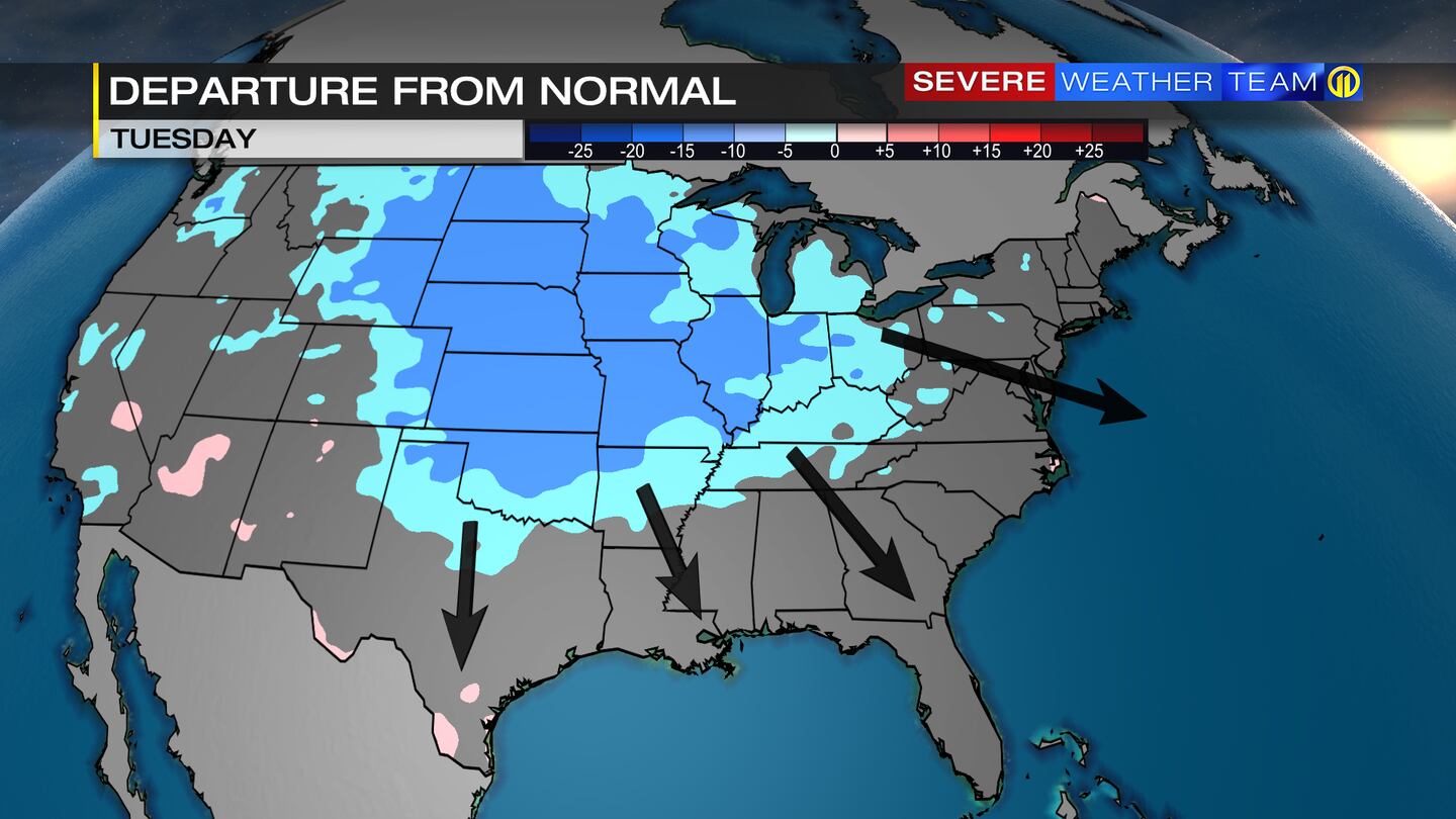
Colder air will pour down from Canada early next week, sending temperatures below normal by mid-to-late week across more than half of the country. Current forecast models are indicating a storm system forming on the back end of this front and riding northeast across the area Thursday and Friday. If enough cold air is in place, snow will be possible or a mix of rain and snow.
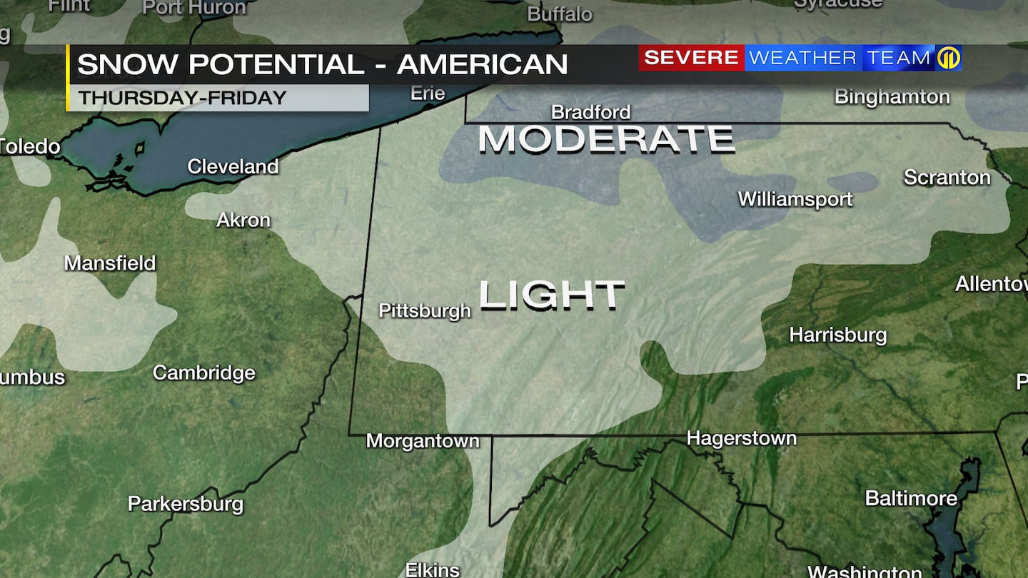
The American GFS model shows the potential for widespread light snow beginning Thursday and ending early Friday next week.
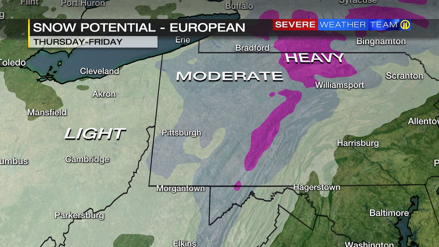
The European forecast model is a little more robust, with the storm giving us a decent shot of accumulating snow by next Friday.
A week out, there is still a lot up in the air on any potential track and strength if a storm system does develop. But know the possibility is there to get an early taste of winter later next week.
Stay with Severe Weather Team 11 and download our FREE Severe Weather Team 11 app to get updated forecasts and videos for your neighborhood.
TRENDING NOW:

Cox Media Group
/cloudfront-us-east-1.images.arcpublishing.com/cmg/XCUXZC2XYZHCRGNNGKFEX6U3LQ.png)


