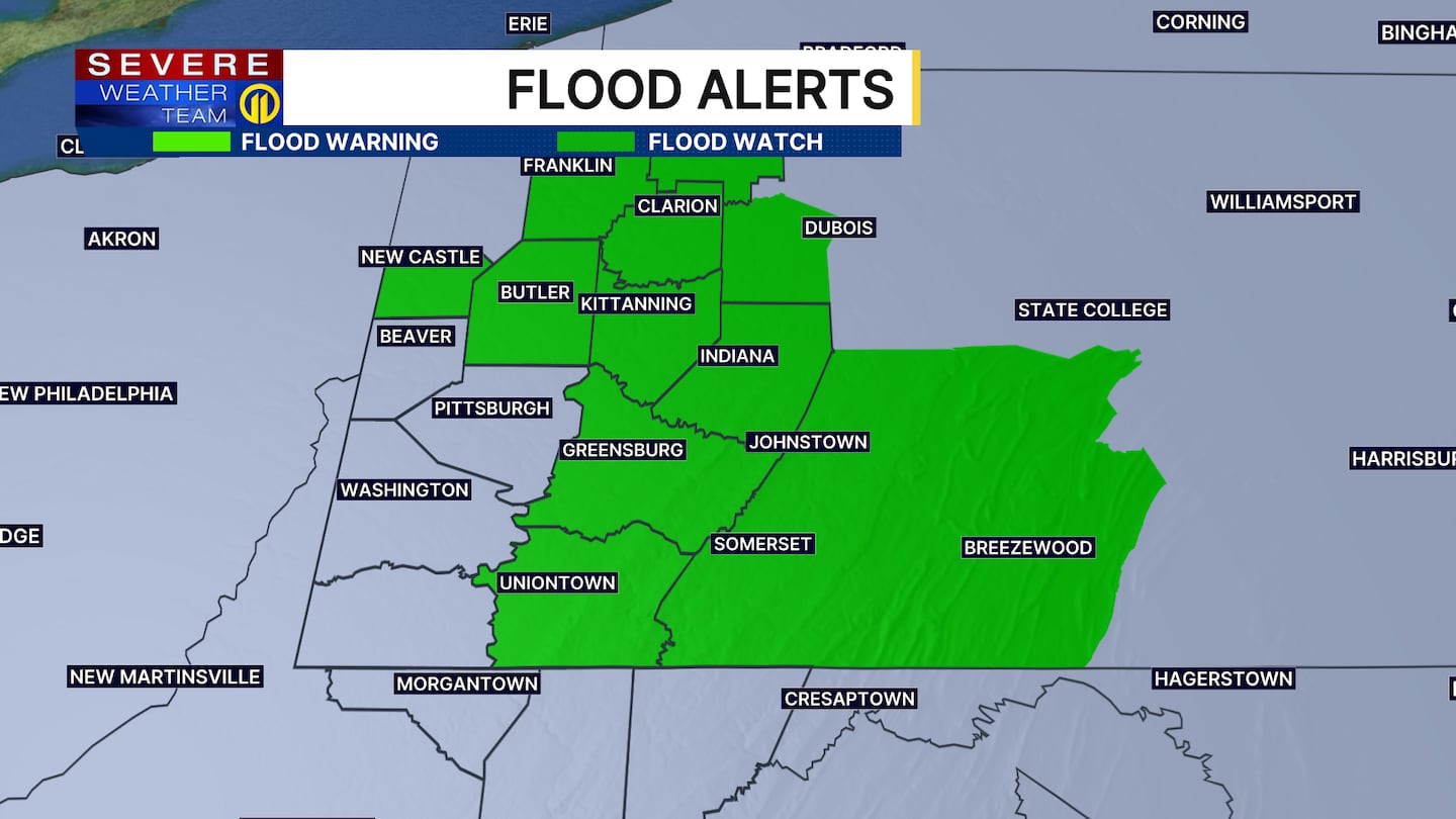
PITTSBURGH — We’ll need to keep an eye on streams and creeks throughout the day for any potential flooding due to ice jam issues.
Morning showers will gradually taper off. A stray shower will be possible this afternoon as a cold front sweeps through the area. Wind gusts could top 40 mph Friday afternoon as colder air races into the area late in the day.
The weekend will start quiet; however, a storm will gather strength Sunday as it grazes the area. The best chance for impactful snow will be south and east of Pittsburgh, but even the city could pick up a coating of snow through the day.
It will be seasonable cold early next week with highs in the low 30s and lows in the 20s. Some moderation is expected closer to the end of the week but more cold air could be coming in early March!
Get the latest forecast on Channel 11 News. Download the Severe Weather Team 11 App for the latest updates and alerts.
Download the FREE WPXI News app for breaking news alerts.
Follow Channel 11 News on Facebook and Twitter. | Watch WPXI NOW
©2026 Cox Media Group
/cloudfront-us-east-1.images.arcpublishing.com/cmg/XCUXZC2XYZHCRGNNGKFEX6U3LQ.png)


