PITTSBURGH — Take advantage of the break in our busy winter weather pattern on Thursday and Friday and plan for major winter storm impacts this weekend.
A fresh blast of arctic air brings some of the coldest air so far this season for Friday night and Saturday, which sets the stage for a southern storm that will bring snow back for parts of the area late Saturday and off and on Sunday.
The track of the storm will determine where the most snow falls, but significant snow is likely for our area.
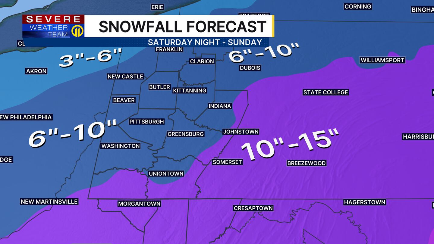
Snow is currently forecast to begin late Saturday and continue off and on through the day Sunday, with additional snow possible through Monday morning. Snow will be heavy at times on Sunday, making travel hazardous, so prepare now and have a plan in place.
The snowfall totals will vary depending on your location, but most areas will see at least 6″ to 10″ of snow through Monday with higher amounts the farther south and east you travel.
Severe Weather Team 11 will be monitoring the latest track and timing of this storm as it develops and making updates, so check the forecast often for the latest snowfall forecasts on air and on the Severe Weather Team 11 app.
Download the FREE WPXI News app for breaking news alerts.
Follow Channel 11 News on Facebook and Twitter. | Watch WPXI NOW
©2026 Cox Media Group
/cloudfront-us-east-1.images.arcpublishing.com/cmg/XCUXZC2XYZHCRGNNGKFEX6U3LQ.png)


