PITTSBURGH — Snow showers will continue to reduce visibility at times and create slick travel in spots this evening. Make sure to use caution when driving. Snow showers will begin to shut off later this evening, but winds will still stay gusty with wind chills in the upper teens and low 20s overnight.
PHOTOS: Squalls bring dusting of snow to western Pennsylvania communities
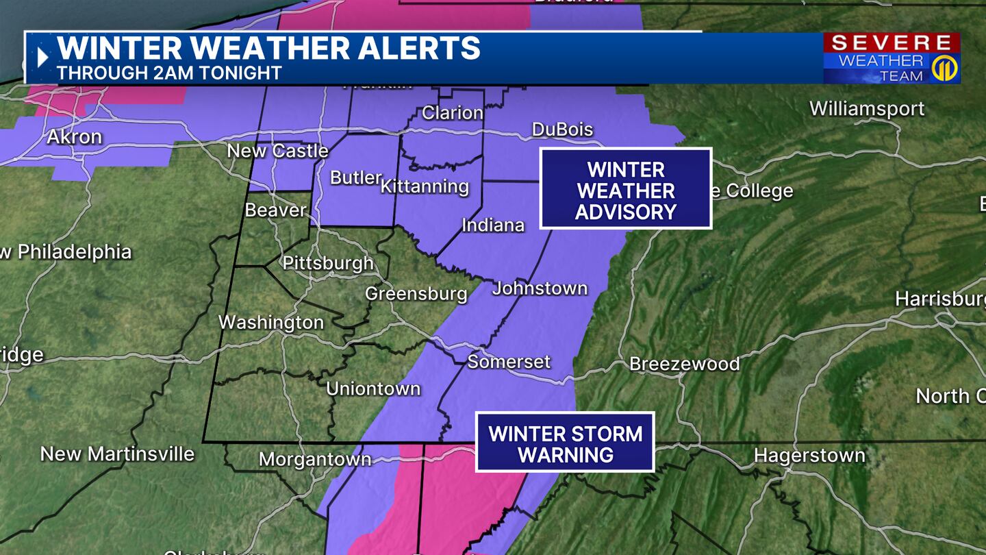

Weather alerts are posted for portions of our viewing area through Monday. A Winter Weather Advisory is in effect for Butler, Armstrong, Lawrence, Indiana, ridges of Westmoreland & Fayette counties until 2 a.m. In the mountains of Maryland & West Virginia, a Winter Storm Warning is in effect for Garrett County, eastern Preston and eastern Tucker counties until 2 a.m. And strong wind gusts are expected to continue in our higher elevations where a Wind Advisory is in effect until noon Monday. Winds in the ridges and mountains could gust up to 50 mph.
Watch as you head out for slick or icy spots on untreated surfaces. It will be a cold start at the bus stop in the morning. Make sure the kiddos are bundled up, wind chills will be in the upper teens and low 20s. Sunshine makes a return tomorrow with warmer marks for the afternoon, highs will reach near 50 degrees. A warming trend is expected again through the week, highs will reach the 60s by Tuesday and possibly the low 70s by Thursday. With this warmup comes unsettled weather for the end of the work week and into the next weekend.
Download the FREE WPXI News app for breaking news alerts.
Follow Channel 11 News on Facebook and Twitter. | Watch WPXI NOW
TRENDING NOW:
©2024 Cox Media Group
/cloudfront-us-east-1.images.arcpublishing.com/cmg/XCUXZC2XYZHCRGNNGKFEX6U3LQ.png)


