PITTSBURGH — Strong winds and scattered snow showers will continue through Monday evening.
Snow will reduce visibility and coat roads, making travel difficult where snow squalls move through. Snowfall from a coating to two inches is possible locally, with higher amounts north of I-80 and in the ridges and mountains.
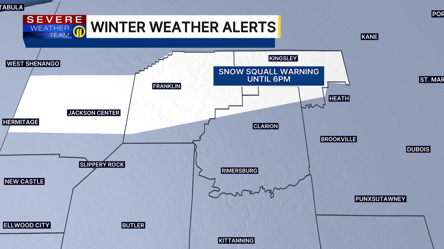
A Snow Squall Warning has been issued for parts of Mercer, Venango, Forest and portions of Clarion counties until 6 p.m.
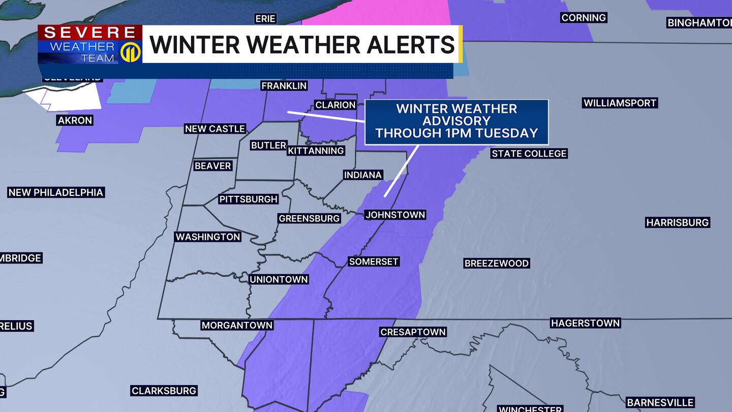
A Winter Weather Advisory continues for areas north of I-80 and in the ridges and mountains where snowfall totals could reach three to five inches through early Tuesday afternoon. Winds will begin to diminish overnight, but still gusts could reach up to 40 mph at times.
Wind chills will be in the single digits to kick off Tuesday morning, with highs in the 20s and wind chills in the teens in the afternoon.
The colder air that settles will stick around with another round of snow for New Year’s Eve.
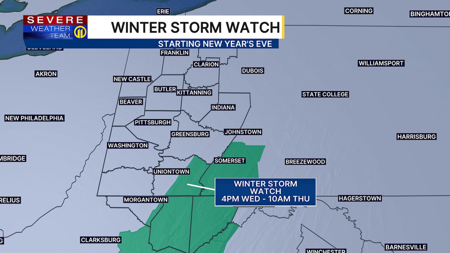
A Winter Storm Watch is in effect for the ridges of Fayette County from 4 p.m. Wednesday through 10 a.m. Thursday. Temperatures will be in the 20s with wind chills in the teens as the ball drops on New Year’s Eve.
Make sure to check the latest forecast tonight on Channel 11 News at 11. Download the Severe Weather Team 11 App for the latest updates and alerts.
Download the FREE WPXI News app for breaking news alerts.
Follow Channel 11 News on Facebook and Twitter. | Watch WPXI NOW
©2025 Cox Media Group
/cloudfront-us-east-1.images.arcpublishing.com/cmg/XCUXZC2XYZHCRGNNGKFEX6U3LQ.png)


