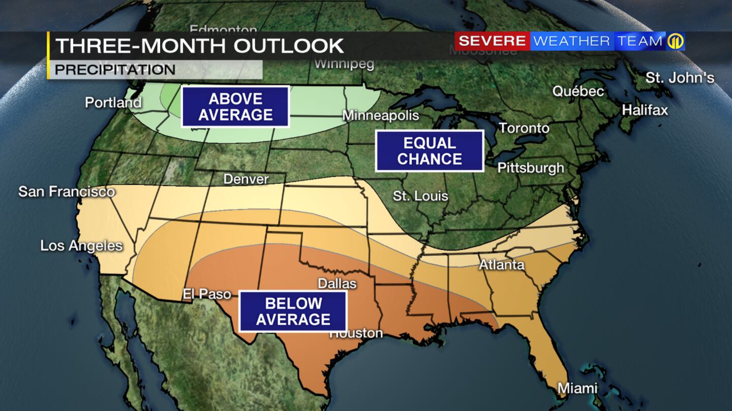
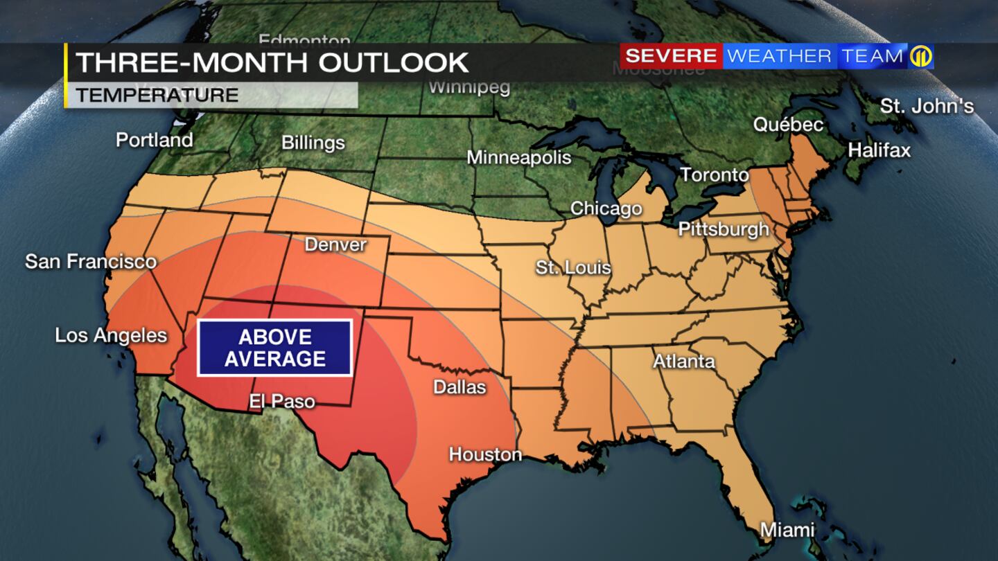
PITTSBURGH — The Climate Prediction Center recently released their outlook for temperature and precipitation for the months of November, December and January. For our area, it favors above-average temperatures during the period, and an equal chance of seeing below or above average precipitation, which includes snow melt. Their reasoning behind the forecast is the La Niña climate pattern, which is expected to continue into the winter months, too.
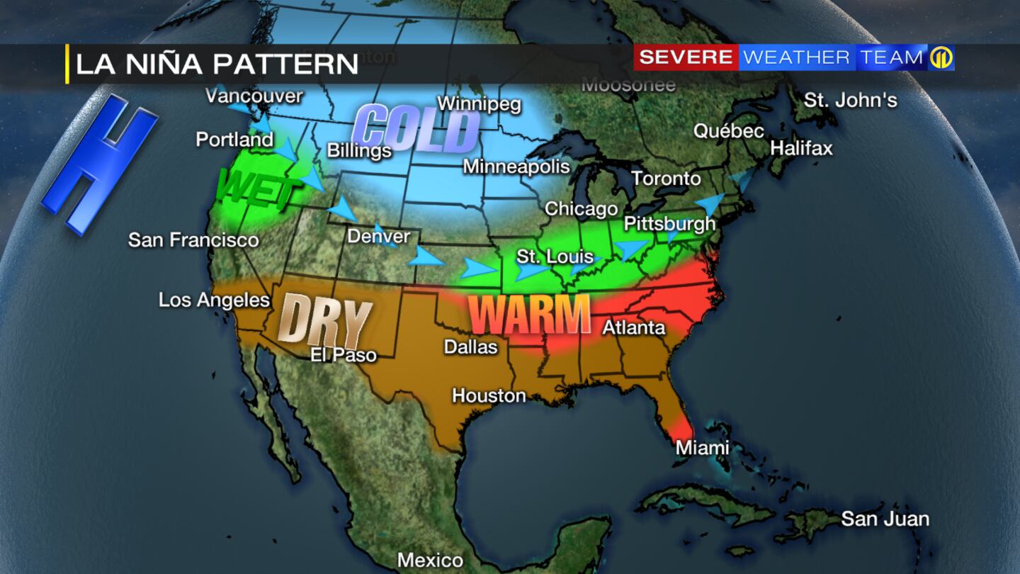
La Niña is the cooling of sea surface temperatures in the equatorial Pacific Ocean. This, in turn, leads to certain changes in our weather pattern that affects our daily weather across the mainland U.S. A La Niña typically leads to warmer and wetter than average conditions for western Pennsylvania.
The average temperature for November is 42.9 degrees, and the averages for December and January are 32.4 and 28.4, respectively. The average for the three-month period is 34.6 degrees.
The average precipitation for the months of November, December and January is 2.93 inches per month.
Predicting whether we’ll have above or below average snowfall is challenging, because there are other climate patterns that affect how much snow we’ll see in our area. For example, the North Atlantic Oscillation and the Arctic Oscillation both can influence snow totals. For example, the negative phase of the North Atlantic Oscillation can bring more outbreaks of cold, which combined with moisture, can lead to more snow.
We’ll keep you updated on how much snow we’re expecting to see this year as winter draws closer. Pittsburgh’s average snowfall is 41 inches, which includes October and runs through April.
TRENDING NOW:

Cox Media Group
/cloudfront-us-east-1.images.arcpublishing.com/cmg/XCUXZC2XYZHCRGNNGKFEX6U3LQ.png)