PITTSBURGH — It’s much colder this morning as temperatures have plunged closer to freezing.
Still, highs today will be seasonable, ranging anywhere from the mid-30s along I-80 to the upper 40s along the Mason-Dixon line with 10-15mph winds.
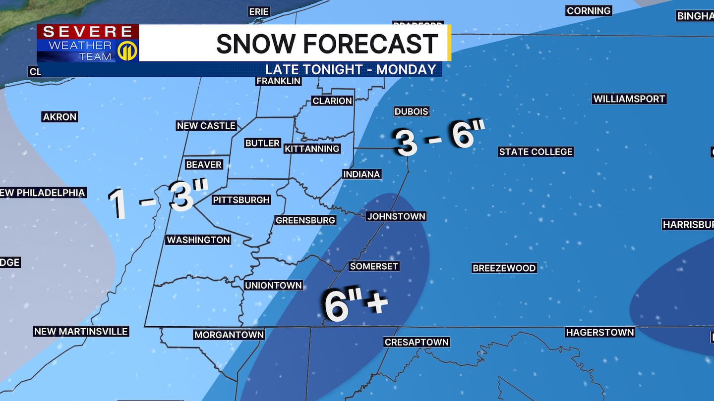
Snow showers are expected to arrive tonight and may result in some accumulations by early Sunday morning. Off and on snow showers will continue Sunday into Monday, adding up to an inch or two across the lower elevations. Higher snowfall totals are expected over the higher terrain, with over 6 inches expected in the ski resorts. Travel impacts will be highest there with the February sun angle and marginal temperatures keeping most roads snow-free in the city.
It will stay cold early next week with highs around 10 degrees below average. Another fast-moving clipper could bring us rain or snow showers late Tuesday night into Wednesday, with another system expected to zip through late Thursday.
Temperatures may moderate a bit toward the end of next week, but more cold air is coming next weekend.
Download the FREE WPXI News app for breaking news alerts.
Follow Channel 11 News on Facebook and Twitter. | Watch WPXI NOW
©2026 Cox Media Group
/cloudfront-us-east-1.images.arcpublishing.com/cmg/XCUXZC2XYZHCRGNNGKFEX6U3LQ.png)


