PITTSBURGH — Snow is less than 24 hours away!
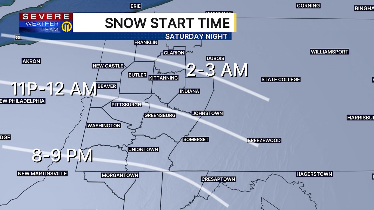
Snow showers could occur as early as 8 p.m. or 9 p.m. on Saturday for areas along and south of I-70. Light snow is expected to start in Pittsburgh around midnight and shortly thereafter for places further north.
Severe Weather Team 11 continues to monitor the incoming snowstorm. Stay with Channel 11 News and WPXI.com for the latest updates.
The snow is expected to become much heavier by Sunday morning, with snowfall rates as high as 1 to 2 inches per hour by the afternoon. Travel will be most dangerous during this time span and may even be impassable.
We will also be watching how far north the sleet line gets, as a warm nose aloft could allow some areas south of Pittsburgh to mix with/changeover to sleet or even a little freezing rain for a period of time. That would keep totals down a bit closer to Latrobe, Uniontown and Morgantown. For areas from the city and points north, this will be mainly snow and could easily reach over a foot under any heavier banding.
Snow will taper to light snow and snow showers Sunday night, but continue off and on into Monday morning. It will stay very cold even behind the system as temperatures plunge below zero in some spots Monday night.
Download the FREE WPXI News app for breaking news alerts.
Follow Channel 11 News on Facebook and Twitter. | Watch WPXI NOW
©2026 Cox Media Group
/cloudfront-us-east-1.images.arcpublishing.com/cmg/XCUXZC2XYZHCRGNNGKFEX6U3LQ.png)