
PITTSBURGH — Our biggest snowstorm in years is coming to Southwestern Pennsylvania this weekend.
>>How local communities are preparing for the incoming storm
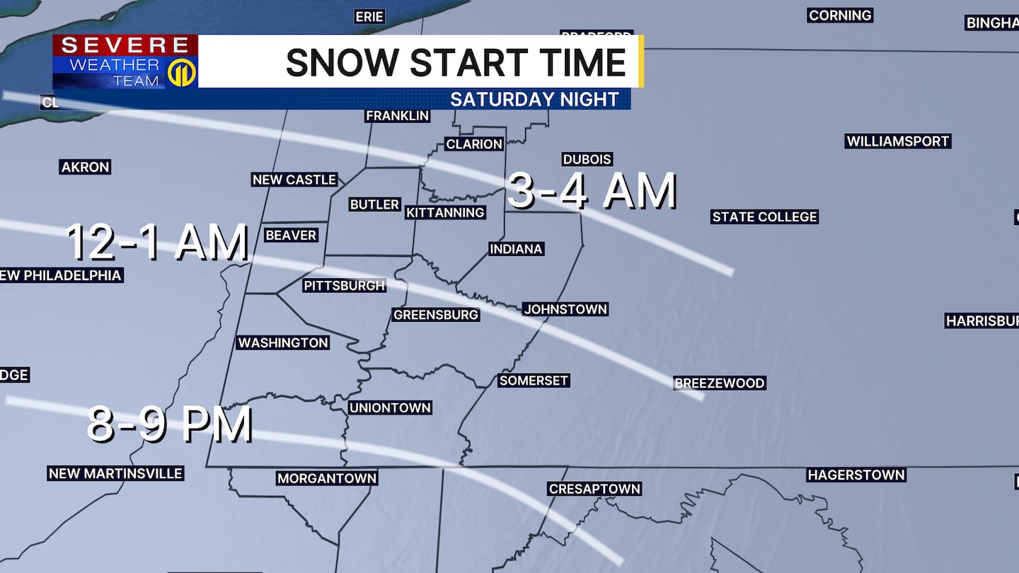
A Winter Storm Warning is in effect for our entire area from 7 p.m. Saturday until noon on Monday.
Severe Weather Team 11 continues to monitor the incoming snowstorm. Stay with Channel 11 News and WPXI.com for the latest updates.
Snow will move in around midnight Saturday night and be fairly light at first. However, as deeper moisture lifts in from the south, snowfall rates will pick up quite a bit Sunday morning. Keep in mind: temperatures will be in the teens, which means snow will be efficient and have no issues sticking.
The heaviest snow is expected to be mid-morning Sunday through the afternoon, with snowfall rates that could reach 1 or even close to 2 inches per hour at times. Travel will be dangerous and possibly impassable during this time.
A warmer “nose” of air aloft may allow some sleet to mix in by Sunday evening for areas along/south of I-70 and over the ridges of southern Westmoreland/Fayette counties. Should that occur, snow totals be a bit lower for our southern counties, but most of us are expected to see anywhere from 8 to 14 inches of snow through Sunday night. Locally higher amounts are possible under any locally intense band that sets up, especially northeast of Pittsburgh.
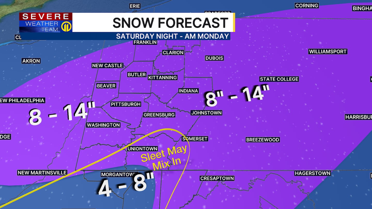
While there can be some lulls at times, snow may not completely wrap up until sometime Monday morning. It will be brutally cold early next week with air temperatures that could plunge below zero Monday night.
Download the FREE WPXI News app for breaking news alerts.
Follow Channel 11 News on Facebook and Twitter. | Watch WPXI NOW
©2026 Cox Media Group
/cloudfront-us-east-1.images.arcpublishing.com/cmg/XCUXZC2XYZHCRGNNGKFEX6U3LQ.png)


