
PITTSBURGH — Hot and humid conditions remain through the evening with heat alerts in effect until tonight.
The entire region is under a Severe Thunderstorm Watch until 9 p.m.
Storms could become severe and produce damaging winds, hail, heavy rain and frequent lightning. Make sure to stay weather aware and have a safe place to move indoors if storms move through.
LIVE UPDATES
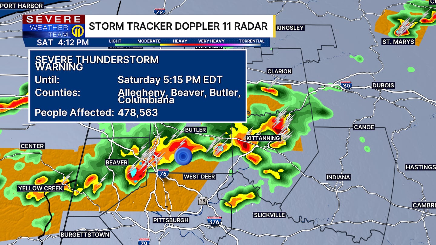
4:15 P.M.: A Severe Thunderstorm Warning has been issued for parts of Allegheny, Beaver and Butler counties until 5:15 p.m.
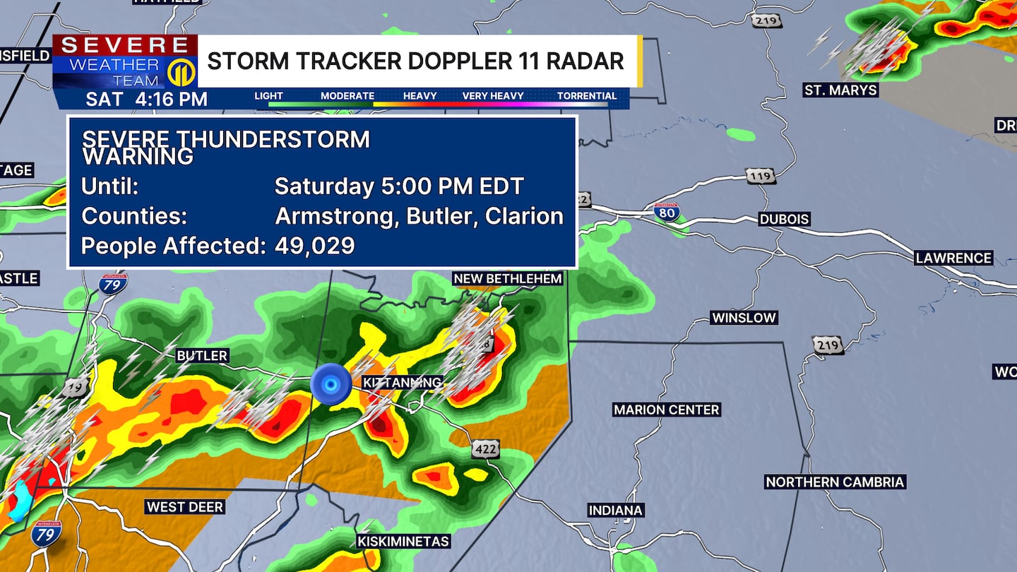
A Severe Thunderstorm Warning has been issued for parts of Butler, Armstrong and Clarion counties until 5 p.m.
3:55 P.M.: A Severe Thunderstorm Warning is in effect for west-central Butler, northern Beaver and southeastern Lawrence counties until 4:30 p.m.
Severe Thunderstorm Warning including Beaver Falls PA, Ellwood City PA and East Palestine OH until 4:30 PM EDT pic.twitter.com/ps2rXZv1dO
— NWS Pittsburgh (@NWSPittsburgh) July 4, 2026
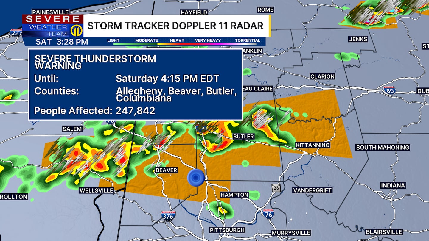
3:35 P.M: A Severe Thunderstorm Warning has been issued for parts of Allegheny, Beaver and Butler counties until 4:15 p.m.
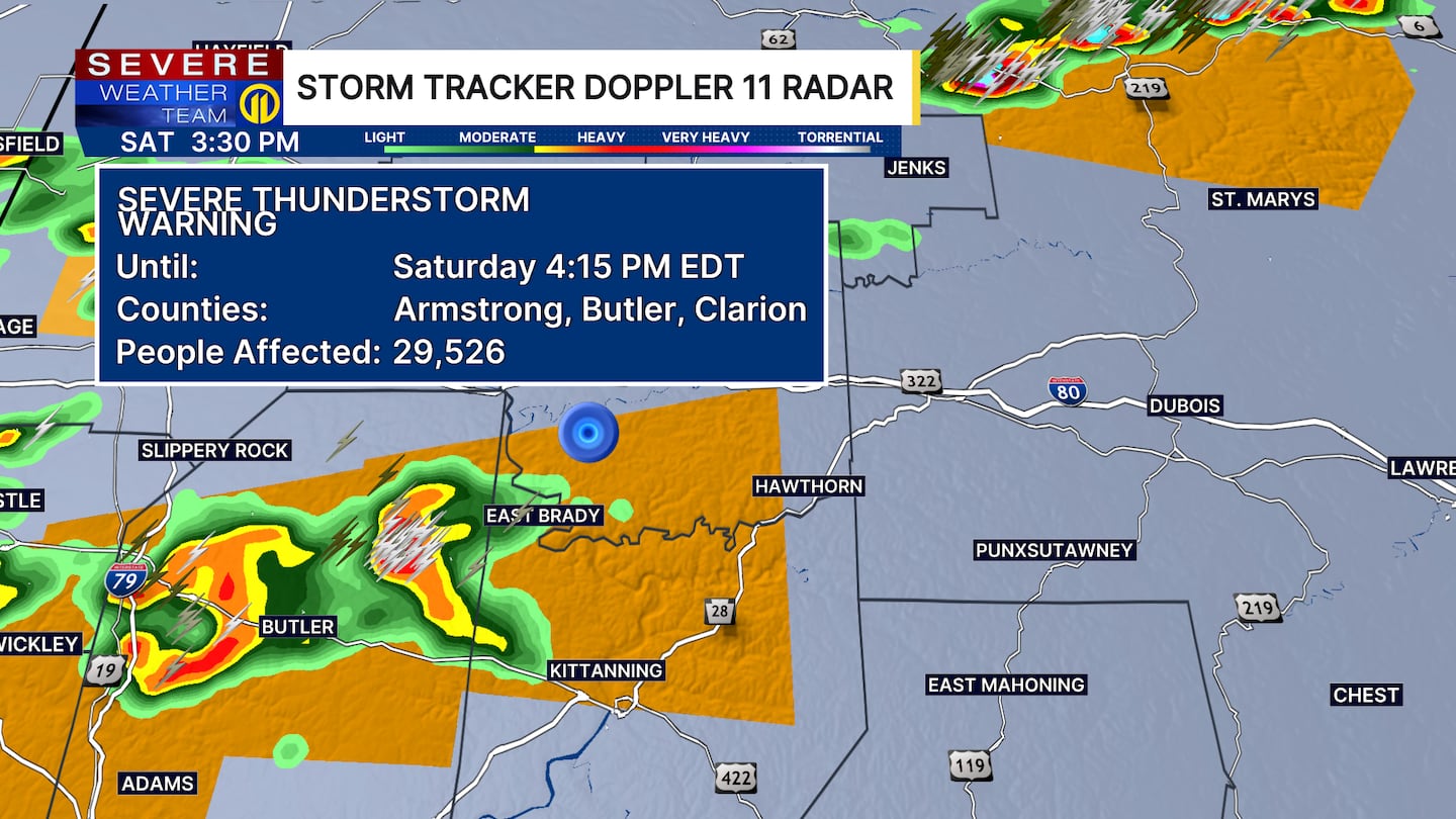
A Severe Thunderstorm Warning has been issued for parts of Butler, Armstrong and Clarion counties until 4:15 p.m.
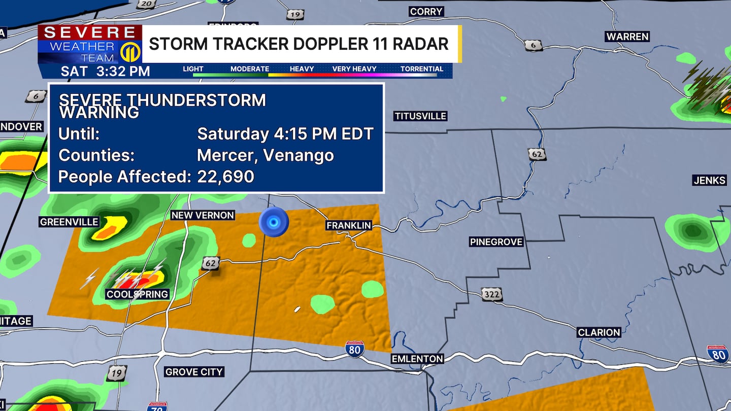
A Severe Thunderstorm Warning has been issued for parts of Venango and Mercer counties until 4:15 p.m.
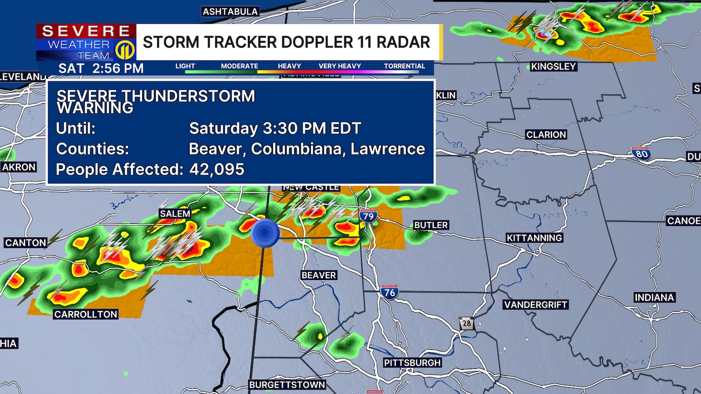
3:20 P.M.: A Severe Thunderstorm Warning is in effect for parts of Beaver and Lawrence counties until 3:45 p.m.

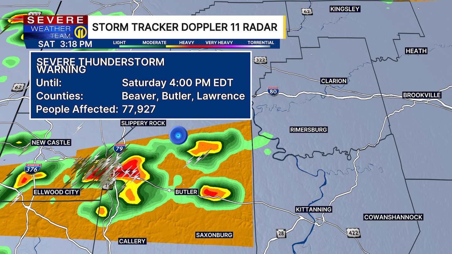
Another Severe Thunderstorm Warning is in effect for parts of Beaver, Butler and Lawrence counties until 4 p.m.
3:15 P.M.: The National Weather Service issued a Severe Thunderstorm Warning for parts of western Beaver and Lawrence counties until 3:30 p.m.
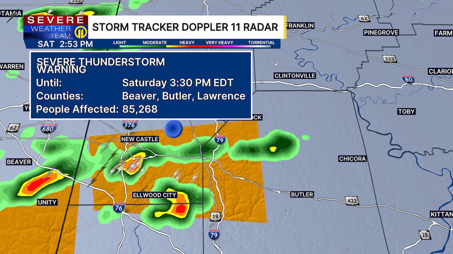
2:55 P.M.: The National Weather Service issued a Severe Thunderstorm Warning for parts of Butler, Beaver and Lawrence counties until 3:30 p.m.
ORIGINAL STORY
Hot and humid conditions remain through the evening with heat alerts in effect until tonight.
The entire region is under a Severe Thunderstorm Watch until 9 p.m.
Storms could become severe and produce damaging winds, hail, heavy rain and frequent lightning. Make sure to stay weather aware and have a safe place to move indoors if storms move through.
Warm and humid still on Sunday and Monday with scattered showers and storms in the afternoon and evening. Storms could be slow-moving and develop heavy pockets of rain that are slow to move, which could lead to a localized flash flooding threat.
Cooler and slightly less humid air arrives Tuesday and Wednesday, giving the area a break from the heat, high humidity and storm activity.
Make sure to stay weather aware and get the latest forecast on Channel 11 News. Download the Severe Weather Team 11 App for the latest updates and alerts.
Download the FREE WPXI News app for breaking news alerts.
Follow Channel 11 News on Facebook and Twitter. | Watch WPXI NOW
©2026 Cox Media Group
/cloudfront-us-east-1.images.arcpublishing.com/cmg/XCUXZC2XYZHCRGNNGKFEX6U3LQ.png)


