PITTSBURGH — Scattered thunderstorms are moving through the area.
Click here to track the storms with interactive radar.
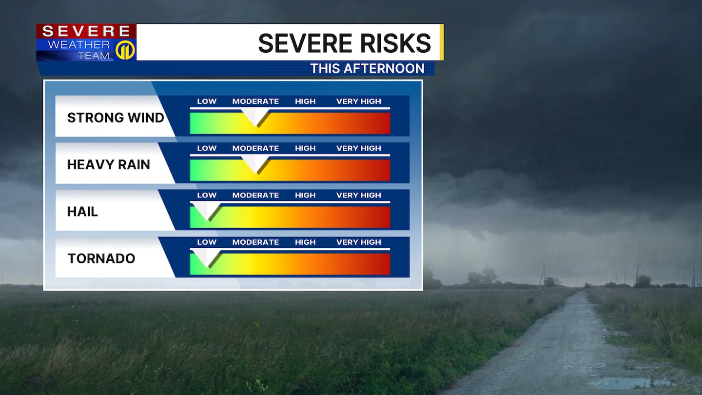
While widespread severe weather is not expected, the strongest of storms are capable of producing locally damaging wind gusts, small hail and heavy rainfall.
Click here to find active severe weather warnings.
Most of the rain should be east of our area by dinnertime, with much cooler air moving in overnight. Clouds and northwesterly winds will keep temperatures a good 15-20 degrees below average Thursday, with highs struggling to get back into the upper 50s.
A major pattern shift is coming this weekend as a strong ridge of high pressure takes control of the Great Lakes region. That, combined with sunshine and southwesterly winds, will allow summer-like warmth to return, with highs well into the 80s by Sunday. Humidity levels will increase this weekend, too, and will make it feel uncomfortable at times.
We may even approach record highs early next week with highs pushing into the low 90s! Get ready for summer!
Download the FREE WPXI News app for breaking news alerts.
Follow Channel 11 News on Facebook and Twitter. | Watch WPXI NOW
©2026 Cox Media Group
/cloudfront-us-east-1.images.arcpublishing.com/cmg/XCUXZC2XYZHCRGNNGKFEX6U3LQ.png)


